La Palma is simply the finest walking island in the Canaries — and one of the best in Europe. Nicknamed La Isla Bonita and, by hikers, the "walkers' island", it packs an enormous forested crater, a ridge of volcanoes marching to the sea, dripping laurel forests and a star-crowned summit into a green world barely 45 km long. A dense, superbly waymarked trail network means you can walk for a fortnight and never repeat yourself. If serious hiking is your holiday, this is the island to book.
This is the island detail behind our wider guide to hiking in the Canary Islands. Here are La Palma's classic routes, from a big-name volcano traverse to gentle forest walks.
Ruta de los Volcanes
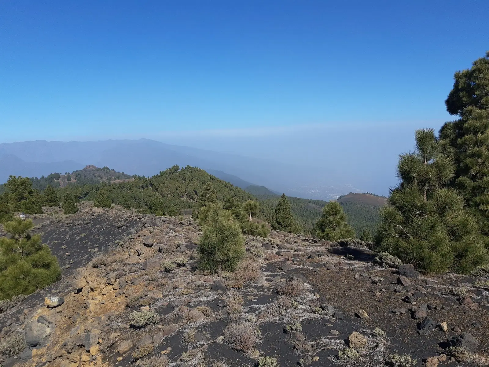
The island's signature walk, the Ruta de los Volcanes, follows the volcanic spine of the south along part of the long-distance GR 131. It's a long, exposed, up-and-down day tracing cinder cones and craters with the Atlantic on both sides — genuinely one of the great walks of the archipelago. It ends near Fuencaliente in the far south, close to the Fuencaliente volcanoes and the island's newest lava from the 2021 Tajogaite eruption, which reshaped the south-west and has since fully reopened.
The Ruta de los Volcanes is a serious full-day route: long, high and utterly without shade, water or shelter. Volcanic gas and ash have occasionally forced sections to close since 2021. Carry ample water and layers, start very early, and check the current status and weather before you set off.
Caldera de Taburiente
At the island's heart, the Caldera de Taburiente national park is an immense forested crater ringed by peaks over 2,000 m and laced with waterfalls and pine. The descent from the Los Brecitos side down to the Playa de Taburiente stream, past the coloured spring of the Cascada de Colores, is a classic La Palma day — long and demanding but unforgettable. Shorter viewpoint walks from the La Cumbrecita gateway give a taste for far less effort.
Los Tilos and the laurel forest
In the wet, green north-east, Los Tilos is a UNESCO-protected pocket of ancient laurisilva — the prehistoric "cloud forest" that once covered much of southern Europe. Trails wind through dripping, moss-hung woodland to waterfalls, while the famous (and much tougher) Marcos y Cordero route follows old water channels through a string of dark tunnels; take a torch and expect to get wet. It's a magical contrast to the bare volcanoes of the south.
Roque de los Muchachos
The island's highest point, Roque de los Muchachos at 2,426 m, crowns the northern rim of the caldera and hosts one of the world's great observatories. You can drive up, but walking the rim ridge to the summit — often above a sea of cloud, with La Palma's neighbours floating on the horizon — is a highlight. It's also the archipelago's premier spot for stargazing once the sun goes down.
The GR routes
La Palma is threaded by two grand long-distance trails: the GR 131, which runs the length of the island along its highest spine, and the GR 130, a gentler mid-level circuit linking the old villages. Between them and dozens of local PR paths, you can string together anything from a lazy half-day to a multi-day traverse. Many walkers base themselves in Los Llanos de Aridane or the pretty capital Santa Cruz de la Palma and range out by car and bus.
Because trailheads sit high and remote, a hire car makes La Palma far easier — though several classic routes (Los Brecitos, Marcos y Cordero) are best reached by the local taxi services that ferry walkers to the top and collect them at the bottom, saving a big road slog.
Much of this network is beautifully maintained and signposted, a legacy of the island's long tradition of walking between villages before roads arrived. That heritage is part of what makes La Palma special: the trails aren't tourist inventions but living rights of way, linking terraces, springs and hamlets that have been connected on foot for generations.
Guided or self-guided?
La Palma's excellent waymarking makes a great deal of self-guided walking easy, and independent hikers thrive here with a map or app. That said, the Caldera de Taburiente descent, the Ruta de los Volcanes and the Marcos y Cordero tunnels all reward going with a guide — for the logistics of point-to-point routes, the safety cover on long exposed days, and the sheer depth a knowledgeable local adds to the geology and forest ecology. For a first visit, one guided day early in the trip is a good way to find your feet.
Difficulty and when to go
| Route / area | Difficulty | Best for |
|---|---|---|
| La Cumbrecita viewpoints | Easy | Caldera scenery, short walks |
| Los Tilos forest trails | Easy–moderate | Laurel jungle and waterfalls |
| Roque de los Muchachos rim | Moderate | Summit views above the clouds |
| Caldera de Taburiente descent | Hard | Big classic full-day route |
| Ruta de los Volcanes | Hard | Fit walkers, volcano spine traverse |
| Marcos y Cordero tunnels | Hard | Adventurous forest-and-tunnel walk |
You can walk almost any month, but spring and autumn are ideal. The green north is cooler and cloudier; the summit ridge can be cold and windy while the coast is warm. See our best time to visit guide for the seasonal picture.
Carry far more water than you think you'll need — the volcano routes have none — plus a hat, high-factor sun cream and windproof layers for the heights. Proper boots with grip are essential on loose lava and scree. Weather and volcanic conditions can change fast; check both, tell someone your route, and never underestimate a long day at altitude.
If you love the outdoors, La Palma deserves a whole trip of its own. Go prepared, respect the sun and the rock, and browse more things to do — though here, the walking really is the main event.