The Caldera de Taburiente is the vast, green, forested heart of La Palma — and one of the most spectacular natural amphitheatres in the world. This immense crater-like basin, ringed by peaks and cloaked in Canary pine, plunges some 2,000 metres from its highest rim to its floor, gouged out over millions of years by erosion and landslides. Declared a national park in 1954, it's the crown jewel of "La Isla Bonita," the pretty island — a place of springs, waterfalls, ancient forests and, on the rim above, some of the clearest, darkest night skies on Earth. For walkers and stargazers alike, it's reason enough to visit La Palma.
Not quite a volcano crater
Despite its name, the Caldera de Taburiente isn't a classic volcanic crater. It began as a volcanic dome, but its dramatic bowl shape was carved out over aeons by water erosion and giant collapses — a process so striking that geologists borrowed the Spanish word caldera ("cauldron") from this very landscape and gave it to science. Today it's a roughly circular basin about 8 km across, its steep walls rising to a jagged rim, with the Barranco de las Angustias ravine cutting a deep exit toward the sea. The scale is genuinely hard to grasp until you stand on the edge and look down.
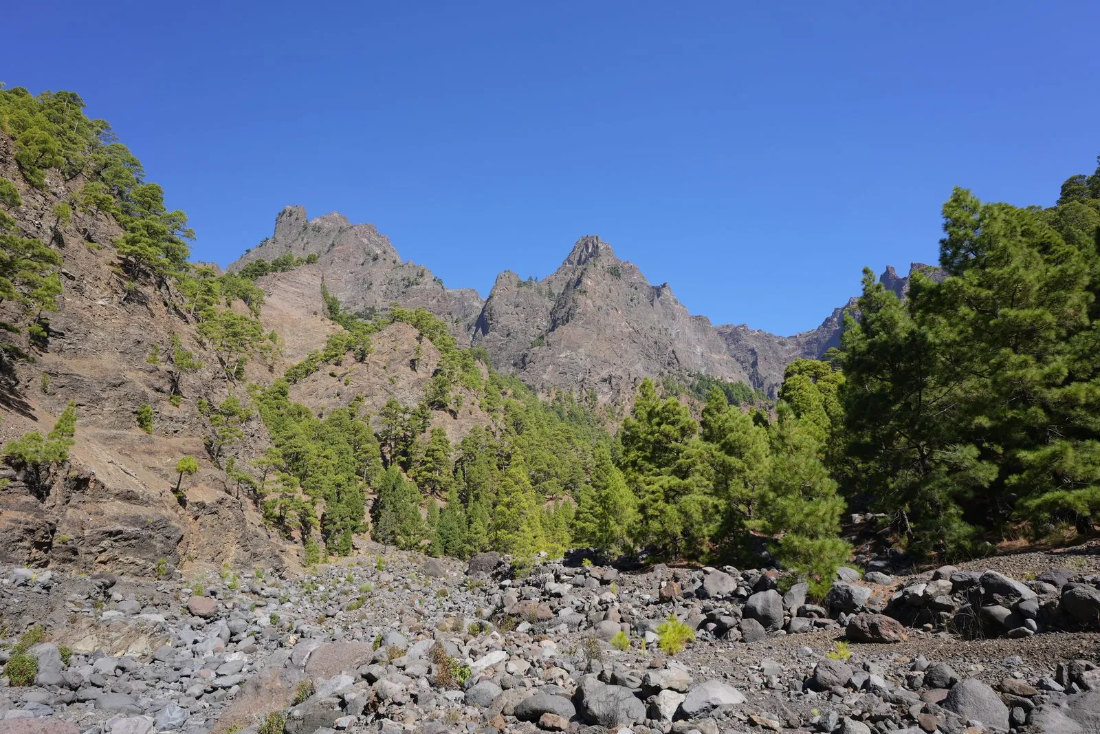
Photo: Ingo Mehling · CC BY-SA 3.0 · Wikimedia Commons · scaled
Roque de los Muchachos: the rim and the stars
The highest point on the rim, and of the whole island, is Roque de los Muchachos at 2,426 m. A road winds all the way up, ending at a viewpoint where — above the clouds — you gaze down into the caldera on one side and out across a shimmering sea of cloud on the other, sometimes with Tenerife's Teide floating on the horizon. Up here too stands one of the world's great astronomical sites, the Roque de los Muchachos Observatory, its domes strung along the ridge to exploit La Palma's exceptionally clear, dark and stable skies.
La Palma was the first place ever certified a UNESCO Starlight Reserve, and it protects its darkness with a pioneering sky law. That makes the rim one of the finest stargazing spots on the planet — on a moonless night the Milky Way is breathtaking, and guided astronomy trips run regularly. Combining a sunset at the rim with a night under the stars is one of the great Canary experiences.
Check the observatory viewpoint access. The area around the telescopes has visitor rules and its own opening arrangements, and guided observatory visits must be booked in advance. As of 2026 the summit viewpoint itself is free to reach by road, but confirm current access, any night-driving restrictions and tour details on the official park and observatory sites before you go.
Springs, waterfalls and the Cascada de Colores
The caldera floor is surprisingly lush, watered by springs and streams that feed a green world of Canary pines. The most famous sight down here is the Cascada de Colores — the "Waterfall of Colours" — where mineral-rich water tumbling over the rock has stained it in vivid ochres, oranges and greens, a natural artwork tucked into the Barranco de las Angustias. Reaching it means a proper walk into the crater, but it's a rewarding target and a highlight of the classic through-hike.
Hiking the caldera
This is world-class hiking country. The signature route starts high at Los Brecitos, descends into the basin, follows the streams past the campsite and the Cascada de Colores, and exits down the long Barranco de las Angustias — a demanding full-day walk of several hours that many hikers rate among the best in the Canaries. There are gentler options too, including short trails and viewpoints around the rim for those who want the drama without the descent.
The full crossing is a serious hike. The main route is long, steep and tiring, involves river crossings that can rise fast after rain, and has little shade in places. Wear proper boots, carry plenty of water and food, start early, and check the weather and trail status first. Many walkers use a licensed jeep-taxi transfer up to the Los Brecitos trailhead rather than driving the rough access track themselves.
Getting there
The main gateway is the El Paso visitor centre, on the road between the airport, the capital Santa Cruz de La Palma and the western Aridane valley — the best first stop for maps, trail information and to arrange the Los Brecitos transfer. A hire car makes exploring La Palma far easier, whether you're driving up to Roque de los Muchachos or reaching the trailheads.
La Palma has its own airport with connections from the other islands and some mainland and international routes, and it's also linked by inter -island ferry. Either way, the island rewards more than a flying visit — pair the caldera with the reshaped southern landscape left by the 2021 Tajogaite eruption, the black- sand beaches and the pretty capital for a memorable few days.
A green cauldron two thousand metres deep, crowned by telescopes and some of the darkest skies on Earth — Taburiente is La Palma at its most sublime.
Walk it by day, watch the stars by night, and you'll understand why they call this the "beautiful island." See more things to do across the Canaries to build it into a wider trip.