Tenerife is a hiker's dream hiding behind a beach-holiday reputation. In a single island you can stand on the roof of Spain, wander a moss-hung cloud forest, and pick your way down a plunging gorge to the sea — often in the same week. The landscapes change so completely from one corner to another that many walkers come back year after year and still haven't run out of trails. If you only associate the island with sunloungers, its mountains will astonish you.
This is the island detail behind our wider guide to hiking in the Canary Islands. Below are Tenerife's standout areas, roughly from the toughest and highest to the gentlest, with an honest word on difficulty and timing.
Mount Teide and the caldera
The obvious giant is Mount Teide — at 3,715 m, Spain's highest peak and the centre of a surreal national park of coloured lava, twisted rock and old craters. You don't have to summit to enjoy it: the trails across the caldera floor around the Roques de García are spectacular and manageable, threading between weird rock formations with the cone towering above.
Reaching the actual summit is a serious, high-altitude undertaking, and the final cone requires a free permit booked well in advance (or you skip the permit by staying overnight in the mountain refuge). At over 3,500 m the air is thin and the weather brutal — freezing, windy and sometimes snowy while the coast is warm.
Teide is high-mountain terrain, not a stroll. Altitude can cause headaches and nausea; the sun at 3,700 m is ferocious; and conditions turn dangerous fast. Carry layers, plenty of water, and never attempt the summit cone without your permit and a proper weather check.
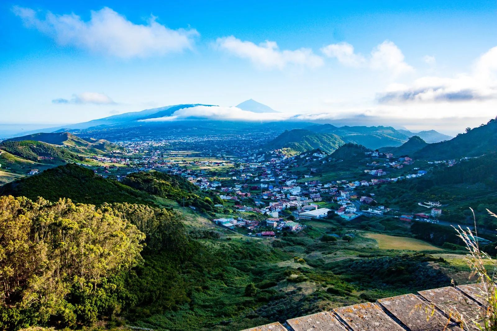
Photo: Jan Kraus · CC BY 2.0 · Wikimedia Commons · scaled
Anaga — the ancient green north-east
For complete contrast, head to the Anaga rural park, a jagged, deeply eroded massif cloaked in laurisilva "cloud forest". This is Tenerife at its most magical: misty, mossy and prehistoric, laced with old footpaths between tiny villages.
- Sendero de los Sentidos ("path of the senses") — a set of short, easy, well-signed loops near Cruz del Carmen, perfect for a first taste of the laurel forest with families or gentler walkers.
- Benijo to Chamorga — a longer, more rewarding coastal-and-ridge route in the wild north-eastern tip, linking dramatic clifftops, hamlets and the black-sand drama of Playa de Benijo.
Masca gorge
The walk down the Masca gorge, from a cliff-hanging hamlet through a narrow ravine to the sea, is one of the island's most famous — and most demanding. It's steep, rocky and long, usually finishing with a boat pick-up from the bottom. Access has been regulated in recent years, typically requiring advance booking and a helmet, so always check the current rules and whether it's open before you plan it.
Barranco del Infierno
Above Adeje in the sunny south, the Barranco del Infierno ("hell's ravine") is a beautiful, moderate there-and-back walk up a green gorge to a seasonal waterfall. Numbers are capped and you must book ahead, so it stays peaceful — a lovely half-day, and handy if you're staying around Costa Adeje.
Teno — the wild west
The Teno massif in the north-west is Anaga's quieter cousin: old volcanic country of terraced hillsides, deep barrancos and the lighthouse headland of Punta de Teno. Trails link villages like Masca and Los Carrizales, and the whole area feels a world away from the resorts.
Trails link villages such as Masca and Los Carrizales through steep, terraced country, and the sense of remoteness is real — this is one of the least-developed corners of a busy island. Combine a Teno walk with the drive out to the lighthouse and you have a superb day away from the crowds.
Guided or self-guided?
The well-marked, popular walks — the Anaga forest loops, the Roques de García circuit, the Barranco del Infierno — are straightforward to do self-guided with a good map or walking app and sensible preparation, and a hire car to reach the trailheads. For the tougher or trickier routes, a guided walk earns its keep: the Teide summit, the Masca gorge and the wilder Anaga traverses all benefit from local knowledge, transport logistics and safety cover, and a good guide brings the geology and plants to life.
Difficulty and when to go
| Route / area | Difficulty | Best for |
|---|---|---|
| Sendero de los Sentidos (Anaga) | Easy | Families, first cloud-forest taste |
| Roques de García (Teide caldera) | Easy–moderate | Big scenery without the summit |
| Barranco del Infierno | Moderate | Half-day gorge and waterfall |
| Benijo–Chamorga (Anaga) | Moderate–hard | Coastal ridge adventure |
| Masca gorge | Hard | Fit, experienced walkers (book ahead) |
| Teide summit cone | Very hard | Permit-holders, altitude-ready |
Thanks to the mild climate you can walk year-round, but pick your zone by the day. The north (Anaga, Teno) is greener and cloudier; the south stays sunnier and drier. Spring brings wildflowers and comfortable temperatures; high summer can be hot and hazy at altitude. See our best time to visit guide for the seasonal detail.
A hire car transforms Tenerife hiking — most trailheads sit high in the hills where buses are sparse. Base yourself in the green north around Puerto de la Cruz or La Laguna if walking is your priority.
Safety first
The island's sun and terrain catch people out. Carry far more water than you expect to need — there are almost no refill points on the trail — wear a hat and high-factor sun cream, and start early to beat the heat. Proper boots with grip are essential on the loose volcanic rock. Weather changes fast: cloud can swallow the Anaga ridges in minutes and Teide can freeze. Tell someone your route, check conditions, and never underestimate a "short" walk with a big climb.
From a lunar volcano summit to a dripping laurel jungle, Tenerife offers a lifetime of walking within an hour of the beach. Go prepared, respect the sun and the rock, and browse more things to do to build the rest of your trip.