Anaga Rural Park is the wild, green, ancient soul of Tenerife. Filling the mountainous northeastern tip of the island, this maze of knife-edge ridges and misty ravines shelters one of the largest surviving laurel forests on Earth — a prehistoric woodland so precious it earned the whole park UNESCO Biosphere Reserve status. It's a different Tenerife entirely from the sun-baked south: cool, damp, impossibly green, laced with hiking trails and dotted with tiny hamlets that time forgot. If you think you know Tenerife from its beaches, Anaga will change your mind in an afternoon.
A forest from the age of the dinosaurs
The heart of Anaga is its laurisilva — laurel forest, a type of subtropical cloud forest that once blanketed much of southern Europe and the Mediterranean millions of years ago, before the ice ages wiped it out almost everywhere. It survives here because the northeast trade winds slam moist Atlantic air into the high ridges, wrapping them in near-constant mist and drizzle that keep the forest permanently damp. The result is a dripping, mossy, primeval world of gnarled laurels, tree heath and ferns, often veiled in swirling cloud — walking through it feels genuinely otherworldly, like stepping into deep geological time.
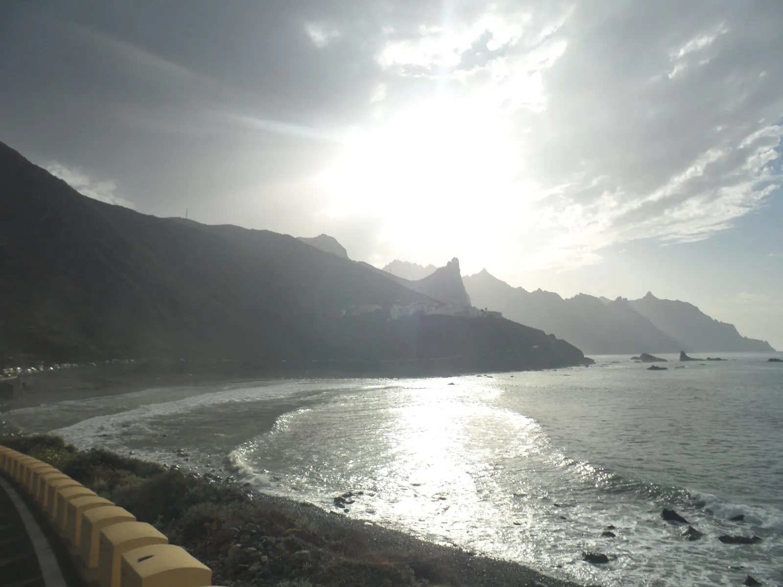
Photo: Noemi M. M. · CC BY-SA 4.0 · Wikimedia Commons · scaled
Misty ridges and dramatic views
Anaga is defined by its topography: a spine of sharp volcanic ridges dropping into deep, V-shaped barrancos on both sides, with roads that cling and twist along the crests. The main ridge road, the Cruz del Carmen to El Bailadero route, strings together a series of miradores with staggering views — north to the wild coast, south over Santa Cruz, and out across a rippling sea of green summits that pierce the cloud. The weather shifts by the minute up here, cloud pouring over the ridges one moment and clearing to brilliant sun the next, which is half the magic.
Hamlets that time forgot
Scattered through the folds of the mountains are some of the most remote settlements in the Canaries. Taganana, spilling down a green valley to the northern coast, is the largest and prettiest, famous for tiny seafood restaurants serving the day's catch. Far out at the eastern tip, Chamorga is a whitewashed hamlet at the end of the road, the trailhead for walks to a lonely lighthouse. Others — El Draguillo, Las Carboneras, Chinamada with its cave houses — cling on where you'd think nobody could live. Stopping for lunch in one of them, plate of fresh fish in hand, is part of the Anaga experience.
Walking in Anaga
This is prime hiking country, with a dense web of ancient footpaths — many once the only links between villages — now waymarked for walkers. Routes range from short, easy strolls to full-day expeditions down to the coast and back, and the shifting light through the forest canopy makes even a gentle walk memorable.
Sendero de los Sentidos
If you have only an hour, walk the Sendero de los Sentidos — the "Path of the Senses" — an easy, mostly gentle loop network starting near the Cruz del Carmen visitor centre. Designed to be experienced with all your senses, it takes you into the thick of the laurel forest on well-made paths, past dripping ferns and moss-cloaked trees, with interpretation panels explaining what you're seeing, smelling and hearing. It's ideal for families and anyone who wants a taste of the ancient woodland without a strenuous walk.
Start at Cruz del Carmen. The visitor centre here has trail maps, toilets, a small café and a produce market at weekends, and it's the launch point for many of the best walks including the Sendero de los Sentidos. Pop in first to check which paths are open and grab current information.
Come prepared for mountain weather. Anaga is often cooler, wetter and cloudier than the coast, and the forest paths can be muddy and slippery even when the resorts are sunny. Bring layers, a waterproof and proper footwear, and don't rely on a phone signal in the deep barrancos. The ridge and coast roads are narrow and winding, so drive slowly and allow far more time than the short distances suggest.
Benijo beach and the coast
Anaga's coastline is as dramatic as its interior. Beyond Taganana, a spectacular road runs out to Benijo, where black volcanic sand meets the Atlantic beneath towering cliffs and the sea stacks known as the Roques de Anaga rise offshore. It's a raw, wild, surfer's-and-photographer's beach — not for gentle swimming, as the currents are strong, but unbeatable for sunset and a plate of fish at the little clifftop restaurants. Read more in our guide to Playa de Benijo before you go.
Getting there
Anaga sits just above Santa Cruz and La Laguna in the island's northeast, so it's an easy add-on to a day exploring the historic north. A hire car gives you the freedom to follow the ridge roads, stop at the miradores and reach the far hamlets at your own pace — just be ready for tight bends and mist. Public buses run to the main villages from La Laguna, but infrequently, so a car or an organised tour makes far more sense if you want to see the park properly.
From the southern resorts it's a longer haul — allow the best part of a day — but pairing Anaga with the elegant old streets of La Laguna, or with the seaside charm of nearby Puerto de la Cruz, makes for one of the best days out on the island.
Cloud forest older than the ice ages, ridges that vanish into mist, and black-sand beaches at the end of the road — Anaga is the Tenerife the brochures forget.