Tiny, round and impossibly steep, La Gomera is a walkers' island through and through. Barely 25 km across, it rises to a misty forested dome at its centre and then falls away in a starburst of deep ravines (barrancos) to the sea. Old footpaths and stone-terraced trails link everything, so on this island you don't so much visit the sights as walk between them. For hikers who want peace, greenery and a network of trails out of all proportion to the island's size, La Gomera is a quiet joy.
This is the island detail behind our wider guide to hiking in the Canary Islands. Here's how to walk La Gomera, from its ancient forest crown down to the coast.
Garajonay national park
The centrepiece is Garajonay national park, a UNESCO World Heritage laurisilva forest that cloaks the island's high centre in moss, mist and prehistoric silence. This is one of the finest surviving stands of the "cloud forest" that once covered southern Europe, kept damp by the trade-wind clouds that snag on the summit. Gentle, well-marked trails wind between gnarled, lichen-draped trees — genuinely magical walking, and mostly easy underfoot.
Alto de Garajonay
The island's highest point, the Alto de Garajonay at around 1,487 m, is a short, steady climb from several directions and rewards you with a panorama over the whole island and its neighbours — Teide on Tenerife often floating above the cloud sea. Popular approaches start near the Pajarito junction or the visitor areas, and you can make it as short or as long as you like by linking forest paths on the way up.
The forest is often wrapped in cool, damp cloud when the coast is sunny — that's the whole point, and it's what keeps the laurisilva alive. Bring a light waterproof and a warm layer even on a hot day, and don't be surprised if visibility drops on the summit.
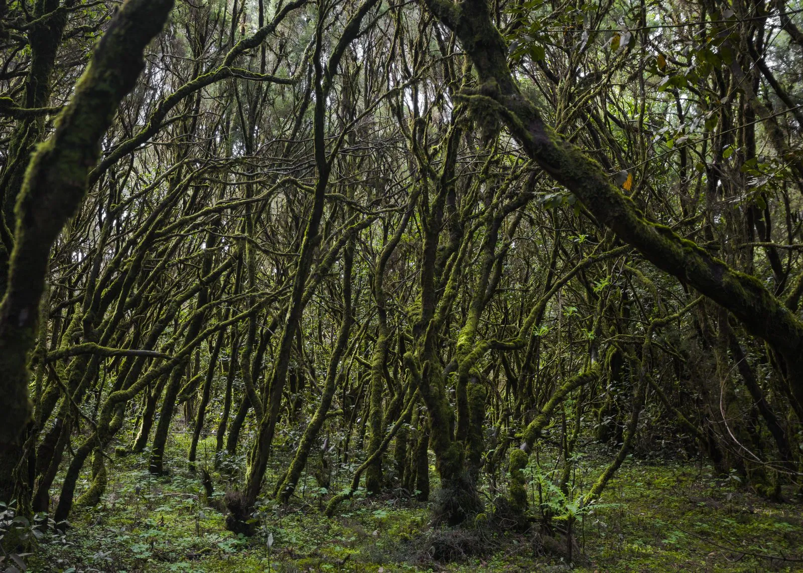
Photo: Diego Delso · CC BY-SA 3.0 · Wikimedia Commons · scaled
Ravine and terrace paths
Away from the forest, La Gomera's magic is in its barrancos. Centuries-old paths cut across terraced hillsides and plunge down ravines between white villages, often following the routes islanders once walked to tend crops and reach the sea. The area around the pretty northern villages of Hermigua and Agulo is laced with such trails, threading past banana terraces, palm groves and old water channels. Near Roque Agando, one of a striking group of volcanic plugs, short paths give big views for little effort.
Valley-to-coast walks
Some of the most satisfying days link the cool green heights to a beach at the bottom. The classic is the long descent through the Valle Gran Rey — the "valley of the great king" — a spectacular terraced gorge that drops from the forest edge all the way to the palm-fringed coast, where you can reward yourself with a swim and a meal. Similar valley-to-sea routes run down towards San Sebastián and Playa de Santiago. Walking one way and returning by bus or taxi saves the brutal climb back up.
A dense trail network
What sets La Gomera apart is how completely the trails join up. You can plan an entire holiday walking point to point — forest to ravine to coast — with barely a repeated step, using the local buses to reset each day. Many independent walkers base themselves in Valle Gran Rey or San Sebastián and range out from there. The island's small size means even a long day's walk keeps you close to a bed and a bar.
La Gomera is a short ferry from the south of Tenerife, making it a superb walking day-trip or short break. See our notes on ferries between the islands to plan the crossing.
The island's other great walking tradition is silbo gomero, the whistled language once used to send messages across these very ravines — a reminder of just how deeply the barrancos have shaped life here. Some restaurants and cultural centres still demonstrate it, and hearing a whistle carry across a valley you've just walked brings the landscape's history to life.
Guided or self-guided?
La Gomera's trails are generally well marked and gentle enough that most walkers explore self-guided with a map or app, using the bus network to link one-way routes. A guide is worth considering for the longer valley-to-coast traverses, where transport back to your start needs planning, and for the natural history of the Garajonay forest, which a good guide brings vividly to life. The island's compact size means you're rarely far from help or a village if plans change.
Difficulty and when to go
| Route / area | Difficulty | Best for |
|---|---|---|
| Garajonay forest loops | Easy | Cloud-forest walking, families |
| Alto de Garajonay summit | Easy–moderate | Island-wide views |
| Roque Agando viewpoint paths | Easy–moderate | Big scenery, short effort |
| Ravine and terrace trails | Moderate | Villages, terraces, quiet paths |
| Valle Gran Rey valley-to-coast | Moderate–hard | Full descent to a beach reward |
You can walk year-round; spring is greenest and autumn warm and settled. The forested centre stays cool and cloudy while the coast is sunny, so dress in layers. See our best time to visit guide for more.
La Gomera's ravine paths are steep, with long drops and loose ground — proper boots with grip are essential, and the valley-to-coast descents are hard on the knees. Carry plenty of water (there are few refills), a hat and sun cream for the exposed lower slopes, and a warm layer for the misty summit. Cloud can cut visibility fast in the forest; tell someone your route and don't underestimate a "downhill" day.
Small, steep and gloriously green, La Gomera rewards walkers like few places its size. Go prepared, respect the sun and the terrain, and browse more things to do to complete your island time.