Yes: the Canary Islands are an active volcanic region, and four of the islands have erupted in the last three hundred years, most recently La Palma in 2021. That does not mean an eruption is likely during your holiday. Volcanoes here erupt every few decades somewhere in the archipelago, not every few years, they give days or weeks of warning, and they are watched around the clock by Spanish and Canarian scientists. In November 2026 six of the seven main islands are at the lowest level on the official volcanic alert scale, and the seventh, La Palma, is one step up because of gas left over from 2021, not because anything new is brewing.
"Active" is a geological word, not a warning. A volcano counts as active if it has erupted in roughly the last ten thousand years and could erupt again. By that measure Teide is active, the Cumbre Vieja ridge on La Palma is active, and the volcanic fields of Lanzarote and El Hierro are active. Gran Canaria is still counted as active too, though its last eruption was around two thousand years ago. La Gomera, by contrast, has been quiet for millions of years.
The islands sit over a hot spot in the African plate, and they were built by eruption; the page on how the Canary Islands were formed explains the geology. This page is about the present: which islands have erupted recently, how the warning system works, and what it means if you are visiting.
Island by island: when each last erupted
| Island | Most recent eruption | Alert level, October 2026 |
|---|---|---|
| La Palma | 2021, Tajogaite (Cumbre Vieja), 85 days | Yellow, for gas in two coastal areas |
| El Hierro | 2011–2012, submarine, off La Restinga | Green |
| Tenerife | 1909, Chinyero | Green |
| Lanzarote | 1824, after the great 1730–1736 eruptions | Green |
| Gran Canaria | About two thousand years ago | Green |
| Fuerteventura | No eruptions in historical times | Green |
| La Gomera | None for millions of years | Green |
Alert levels are from the Canarian government's volcanic emergency plan as reported by Diario de Avisos on 22 October 2026. They can change, and the current level is always on the government's emergency pages.
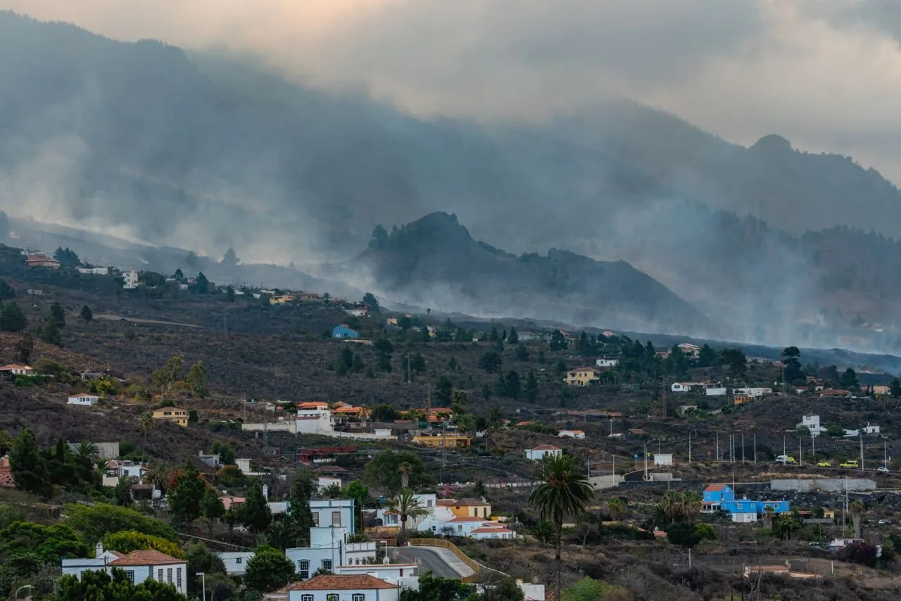
Photo: Eduardo Robaina · CC BY-SA 3.0 · Wikimedia Commons · converted
La Palma: the 2021 eruption and the gas that lingered
On 19 September 2021 a fissure opened on the western slope of the Cumbre Vieja ridge, and for 85 days lava ran down through villages and banana farms to the sea. It stopped on 13 December and was declared over on Christmas Day. Thousands of buildings were lost, but nobody was killed by the lava, because the eruption was preceded by a week of earthquakes and evacuations ran ahead of the flows. The full story is on our page about the 2021 La Palma eruption.
What most visitors do not realise is that, five years on, La Palma is still at yellow on the alert scale. The reason is carbon dioxide. Volcanic CO2 is heavier than air and still seeps into ground floors and basements in Puerto Naos and La Bombilla, two coastal communities in Los Llanos de Aridane, and readings are also taken at Tajuya. Yellow means daily life carries on as normal but the public should follow civil protection notices. Before booking a stay at Puerto Naos, check what has reopened; the rest of the island is unaffected.
Yellow on La Palma is about air, not lava. The yellow level that has stayed in place since the eruption is a measure for gas in a few streets, decided by civil protection rather than triggered automatically by scientific data. It does not mean a new eruption is expected, and it does not affect hiking, the observatories or the capital.
El Hierro: the eruption you could not see
In October 2011 the sea a couple of kilometres off La Restinga, the fishing village at the southern tip of El Hierro, began to bubble and turn green, and steaming lumps of pumice floated to the surface. A submarine volcano had opened on the sea floor. The village was evacuated for a time, the marine reserve was closed, and the eruption ran into early 2012.
It left a new cone under the sea, now called Tagoro, whose summit lies well below the surface. Divers around La Restinga today swim over a seabed that was reshaped in living memory, and the reserve has recovered. It is a useful reminder that not every eruption in the Canaries happens on land, and that a quiet sea can hide a working volcano.
Tenerife and Teide: watched, and restless
Teide is the tallest volcano in the islands and the one people ask about most. Its summit cone last erupted more than a thousand years ago, but Tenerife has had several eruptions in historical times on its flanks: in 1704 and 1705, in 1706, when lava destroyed the harbour of Garachico, in 1798 on the side of Pico Viejo, and most recently at Chinyero in 1909, in the west of the island.
The island is not asleep. The Instituto Geográfico Nacional has recorded unusual seismic activity beneath Las Cañadas, the great crater around Teide, since 2016, and 2026 has been busier still: RTVC reported in August 2026 that ten seismic swarms had been detected under Teide that year, against six in all the years before. Tenerife also gives off the highest diffuse CO2 emissions in the archipelago. Most of these earthquakes are tiny and are not felt, though scientists have said residents may occasionally feel a tremor.
The scientific committee of the regional emergency plan met repeatedly in 2026 and ruled out an imminent eruption. Its conclusion in August was that the probability of an eruption in the short or medium term remains very low, because an eruption requires magma to push into the crust and no such intrusion has been detected. The island stays at green, with formal reviews every three months.
Lanzarote: the biggest eruption in recent history
Lanzarote's landscape is the result of the longest eruption the islands have seen in historical times. From 1730 to 1736 a chain of vents opened across the west of the island, burying farmland and villages under lava and ash; a smaller eruption followed in 1824. That lava is now Timanfaya National Park, where the ground a few metres down is still hot enough for rangers to set brushwood alight and send water up as a geyser.
That heat is residual, not a sign of a coming eruption. Lanzarote stays at green, and the volcanic fields are monitored like the rest.
Who watches the volcanoes
Two scientific bodies do most of the work. The Instituto Geográfico Nacional (IGN), the Spanish state agency, is responsible for volcanic monitoring in Spain and runs networks of seismometers, GPS stations and other instruments on every island, publishing earthquake data daily. The Instituto Volcanológico de Canarias (Involcan), a Canarian institute, adds its own measurements, especially of volcanic gases and ground temperature.
Their data goes to the scientific committee of the Canarian government's volcanic emergency plan, known by its Spanish initials as PEVOLCA. The committee advises, but the decision to change the public alert level is taken by the regional civil protection authorities. In practice, the islands have some of the best-instrumented volcanoes in Europe, and it was that network that spotted the 2021 eruption days in advance.
The traffic light, and the phone alert you might receive
The public alert system is called the semáforo volcánico, the volcanic traffic light, and it has four colours. Green means normality and no protective measures. Yellow means people carry on as normal but should follow official notices. Orange and red come with specific instructions for the areas concerned, up to evacuation. Each island has its own colour, and parts of an island can be treated differently.
If an alert ever needed to reach people quickly, it would arrive on your phone. Spain's ES-Alert system sends warnings to every mobile in an area, whatever its network, and visitors' phones receive them too. Tenerife tested it on 22 October 2026 during a volcanic emergency drill called Volcanex, with three test messages between 9:00 and 14:00 announcing a simulated change to orange; RTVC noted that phones on other islands and on the ferries could pick it up as well.
A drill message on your phone is not an evacuation. Test alerts are labelled as exercises and announced in the Canarian press beforehand. Keep your phone switched on and out of flight mode, because a phone that is off cannot receive the alert, and follow the instructions in any real message, which would be sent only to the areas affected.
What this means for your trip
Very little. An eruption in the Canaries is not a sudden explosion of the kind seen at some volcanoes elsewhere. The islands' volcanoes are mostly basaltic, with lava that moves slowly, and every recent eruption has been preceded by days or weeks of earthquakes that the monitoring network picked up. The realistic disruptions are local road closures, ash at an airport for a few days, or a stretch of coast closed off, as happened on La Palma in 2021.
The volcanic risks you might actually meet are mundane. On Teide the danger is altitude, cold and sun, not lava, and the summit path now needs a paid permit; our page on getting a Teide summit permit explains it. On fresh lava, such as the 2021 flows or the cones at Fuencaliente, the rock is sharp and can hide hollows, so stay on marked paths. Travel insurance that covers natural events is sensible for any trip, as it is anywhere.
So, should the volcanoes worry you?
No, but they should interest you. The Canaries are among the few places in Europe where you can walk across lava younger than your parents, see a valley rebuilt after an eruption, and stand on a volcano that scientists are actively studying. That is why the islands' parks, from Teide to Timanfaya, are among the most visited in Spain, as our overview of the four national parks shows.
The volcanoes are active, watched closely and, for now, quiet enough that the official alert sits at green on six islands and yellow on one for gas, not fire. If that ever changes, you will know through official channels and your phone well before it matters, and the islands have shown in 2011 and 2021 that they know how to keep people safe.